|
|
Do It In Hawaii
|

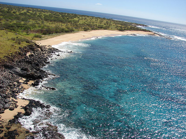
The beach at Keanakeiki on the far west end of Kahoolawe Island
Photo Credit: Forest and Kim Starr (USGS)
ISLAND NAME: Kahoolawe Island
ALSO KNOWN AS: The Target Isle / The Lonely Island / The Desolate Isle
AREA: about 45 square miles (about 28,800 acres)
LENGTH: about 11 miles
HIGHEST POINT: 1477 feet above sea level
ANNUAL RAINFALL: less than 25 inches
COUNTY: Maui County
PERMANENT RESIDENT POPULATION: zero
PHYSICAL SIZE: about 45 square miles
The Hawaiian island of Kahoolawe is situated between the islands of Maui and Lanai. It has been used at different times in its history as a penal colony, a ranch, a forest reserve, and a military training and testing ground.
There are no hotels, restaurants or any type of tourism infrastructure on Kahoolawe. There is still a danger of visitors encountering unexploded ordnance on the island so access is limited to those who receive permission from the Kahoolawe Island Reserve Commission for purposes related to restoration, education, and Hawaiian culture.
Articles About Kahoolawe Island
Attractions on Kahoolawe Island
RELATED RESOURCES:
-
Other Hawaiian Islands
-
About the Islands of Hawaii
Note that Hawaii's entities can change or even disappear over time. When you are planning a visit we recommend contacting entities directly to confirm the details you care about.