|
|
Do It In Hawaii
|

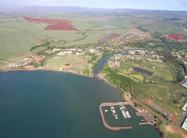
Photo Credit: Christopher Becker (cc30)
COMMUNITY NAME: Hanapepe
NAME IN HAWAIIAN: Hanapēpē
STATUS: census designated place
PHYSICAL SIZE: 1.03 square miles
POPULATION: 2,678 (as of 2020 census)
ELEVATION: 92 feet above sea level
ZIP CODE: 96716
SITUATED: west of Eleele, east of Kaumakanai
ISLAND AND REGION: West Kauai Island
COUNTY: Kauai County
Attractions
- Hanapepe Neighborhood Center
- Hanapepe Stadium
- Hanapepe Tennis Courts
- Hanapepe Heights Down Park
- Hanapepe Swinging Bridge (just outside east Hanapepe border)
Dining
- Aaron's Kitchen
- Unko's Kitchen
Pictures:
commons.wikimedia.org --> hanapepe --> images category
Articles:
-
gohawaii.com --> kauai --> hanapepe town
-
to-hawaii.com --> kauai --> cities--> hanapepe
-
wikipedia.org --> hanapepe --> article
NEARBY TOWNS:
- Eleele | Profile |
- Kaumakani | Profile |
RELATED RESOURCES:
-
More About Towns on Kauai Island
-
Introduction to the Island of Kauai
-
Towns in All of Hawaii
Note that Hawaii's entities can change or even disappear over time. When you are planning a visit we recommend contacting entities directly to confirm the details you care about.